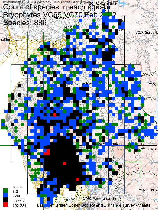
Select from the drop-down list below to view the distribution map for a bryophyte species in Cumbria VC69 & VC70. The first map shows the number of species in each monad, tetrad or hectad; clicking on a square will list the species below the map. Click to see more details. Dates are for most recent record. Data set: January 2026, not guaranteed complete. Any records without a date have been given year 1500.
The maps use the new taxon names.
On a laptop: click on the list and then start typing the name (quickly) to find a species. Then press enter; you can now move between maps using the arrow keys.
|
|
Map generated by